
Donation Land Claim Maps
These maps are of the area around Pleasant Hill Cemetery (later, Pleasant View Cemetery) on Ladd Hill, south to the Willamette River. They indicate some of the original land claims, early family land divisions, and land ownership. Many of the names on these maps are recognizable from the cemetery monuments and may offer clues to family and neighborhood relationships. Spellings on maps were usually phonetic, so often included spelling errors.
Click on the individual map for a much larger view.
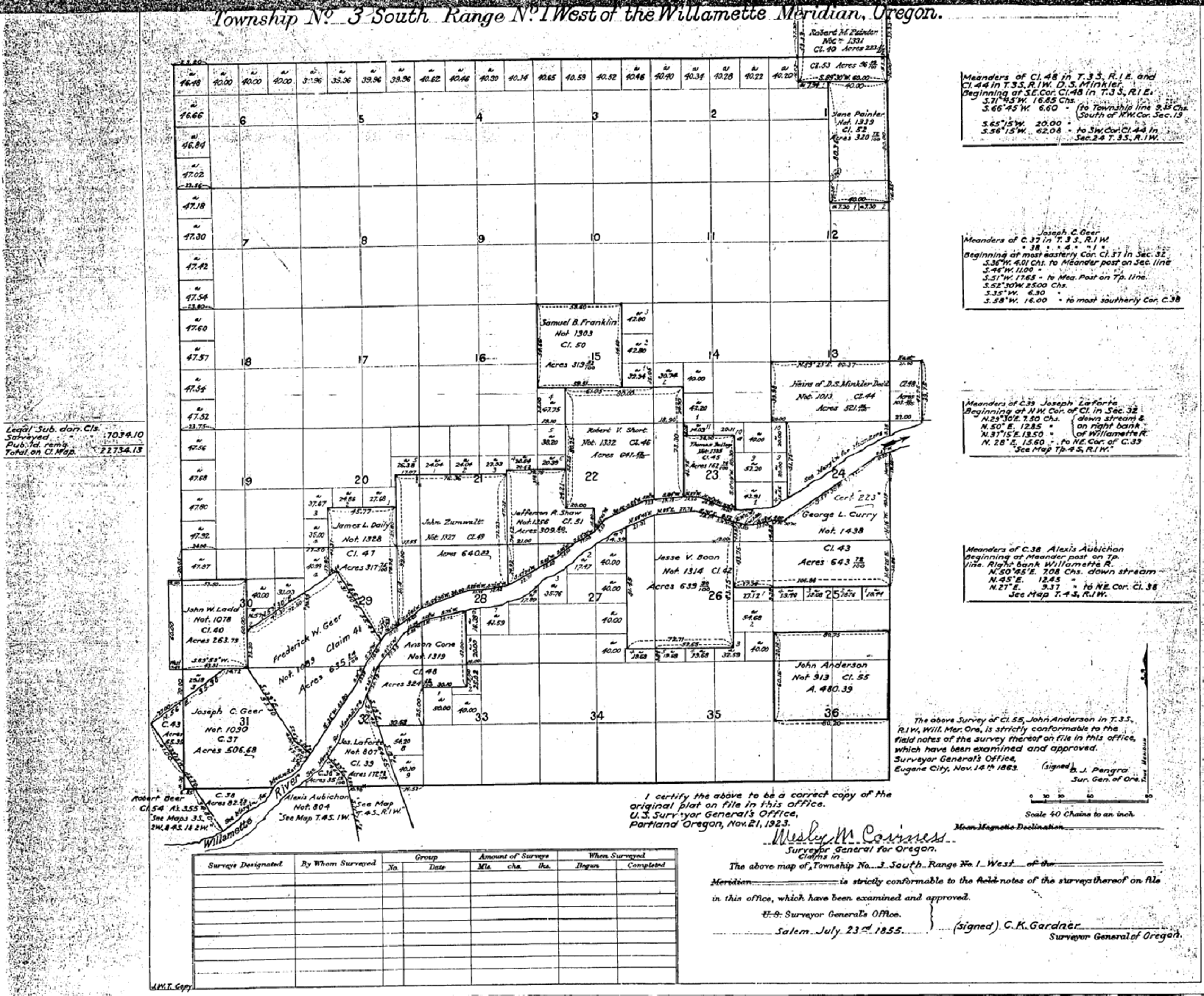
1855 Donation Land Claim Map
This 1855 map is the earliest known DLC map of the area around the Willamette River near Wilsonville. Notice that the first claims were all along the river, the primary transportation facility. The cemetery has not been located yet, but will eventually be in section 9, SW quarter.

1862 West Section
This 1862 map is of the Ladd Hill area west of Wilsonville. The cemetery is located in the southern part of the Moses M. Baker claim near the center but is not yet marked on the map. The path of the Willamette River is indicated by river markings across the lower right. The Corral and Mill Creek system is the main stream system in the center. This map overlaps slightly with the 1862 East Section.

1862 East Section
This 1862 map is of the Ladd Hill area near Wilsonville, which has not yet been named. The path of the Willamette River can be seen across the lower portion. Coffee Lake, here labeled as “The Black Swamp”, is the main body of water north of the Willamette. This map overlaps slightly with the 1862 West Section.
.

Section Map Post-1865
This map, drawn sometime after 1866, is of the area around Pleasant Hill Cemetery. The cemetery is named here as “Pleasant Hill Cemetery” in the southern part of the Moses M. Baker claim in the second row from the top. The path of the Willamette River is shown. M.C. Young purchased part of the R.V. Short and Franklin DLC’s sometime in the 1880’s and is penciled in to indicate that, but the exact date of the underlying map is unknown.